Background:
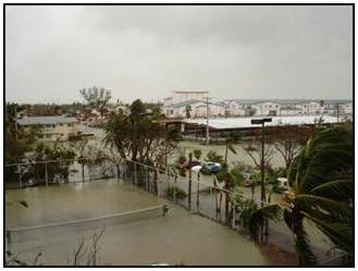
 In 2005, Hurricanes Katrina, Rita, and Wilma destroyed homes, businesses, infrastructure, and natural resources along the Gulf and Atlantic coasts. In the aftermath of the storms, federal, state, and local governments, service agencies, and the private sector responded by helping to rebuild the hurricane-ravaged areas and restore the local economies. GIS helped responders assess damage, monitor the weather, coordinate relief efforts, and track health hazards, among many other critical tasks, by providing relevant and readily available data, maps, and images.
 Objective:
In this week’s project, we used some of the same data that guided critical decisions, such as funding and safety measures. The focus area was Key West Florida and the impact of the storm surges from Hurricane Wilma. The amount of flooding was really quite dramatic. As you look at the three maps below, first look that the elevation map, then segue to the two different flood maps. It also dramatically shows how important it is to be prepared for events such as this, especially if you live in areas prone to hurricanes.
Deliverables:
- A map of elevation and bathymetry of Key West and Key West places and streets
- A Map of flooded land in Key West after the two storm surges
- A bar graph showing the percentage of total flooded land by land-cover type
- A map showing infrastructure and heath facility destruction
- A table showing various land types measured in acres and square miles
Notice the highest elevation is 3.75 meters. The contour map on the right is another ways to portray elevations.
Notice the amount of flooding on the various land types. As you look at the maps, you can see the few areas not flooded highlighted in red. The legend on the left helps to identified four types of land cover: 1) developed, 2) barren, 3) scrub/grass and 4) wetlands. The flood was devastating to Key West.
Note the infrastructure at risk (Hospitals, Airfield, Churches, schools and roads) during a flood.
Storm Surge
Hurricane Wilma flooded a majority of the land in Key West, FL. There were two separate storm surges the highest was 8 ft (2.4m) from the Gulf of Mexico completely inundated most of the lower keys.Low-lying areas of Key West and the lower Keys, including major tourist destinations were under up to 3 ft (.9 m) of water from the [initial] storm surge. 60% of the homes in Key West were flooded.[1] Much of the original areas did not flood due to their higher elevations of 12–16 ft (3.7-4.9 m).[1] The surge destroyed tens of thousands of cars throughout the lower Keys and many houses were flooded with 1–2 feet (.3-.6 m) of seawater. The peak of the [second] storm surge occurred when the eye of Wilma had already passed over the Naples area, and the sustained winds during the surge were less than 40 mph (64 km/h).[1]
FEMA has a graph (seen below) that maps out the predicted vs actual surge. It does much to explain the surprise on the island. See how the blue predicted lines varies significantly from the actual surge.
Looking at total acreage, the developed land were the most flooded. In terms of percentage, it was nearly 100% flooding for all categories except some of the developed areas on higher ground. Almost all of the schools, churches and streets were flooded. The two hospitals and the airport were also flooded by the storm surges. Of the developed land, 1,770 acres were flooded. Hurricane Wilma’s two storm surges devastated the majority of Key West.
Restoration Plan
I think two things should happen in parallel. There should be a restoration plan and a plan to update the hurricane models. Given that Key West is a small area, the costs should also be taken into consideration. In other words, determine what is most important and what efforts will give the biggest bang for the buck.
The initial restoration effort should focus on rebuilding the hospital and building a seawall around the one in the lower elevation. The next step in restoring the community could be the addition of Heliports near or on the Hospitals since rebuilding an airfield would be cost prohibitive. A sea wall could be built around the main runway.
The arterial infrastructure should be next. Repairing streets would allow residents to return and rebuild their homes and businesses. The low sections of the central road corridor could be elevated more to allow for an escape route in future hurricanes. Given that this is a big tourist area, large ships regularly come into port. These ports could be used to evacuate more people. Ferries could be added to assist moving people and cars.
The flooded wetlands will take a much longer time to recover and perhaps some conservation agencies can assist in restoring these areas. Additional sea buoys could be added to improve the surge prediction models.
Updating the Key West Hurricane evacuation plan would be very beneficial. This will help to ensure everyone is working together. It was clear that general hurricane preparedness could be improved. It seemed from the literature about that the residents lacked a sense of urgency prior to the event. We witnessed a similar effect prior to hurricane Rita. So there needs to be a coordinated effort from the grass roots up and the government down to teach and prepare for future events since it is not a question of “if” but “when” it will happen again.
[1] http://en.wikipedia.org/wiki/Effects_of_Hurricane_Wilma_in_Florida#cite_note-8


No comments:
Post a Comment