
Scenario
Around 3:00am on May 15, 2003, a tractor trailer carrying 20,000 pounds of hazardous material overturned in downtown San Francisco. The CA state Police and local emergency responders both responded at the site to coordinate the accident response. In As City Planner for the city of San Francisco you have been asked to create maps for the police department as well as the local public in order to better aid in the evacuation efforts.
Problem
California state police arrived first and recorded the location with GPS receivers and identified the substance as hazardous. Officers needed maps showing the vulnerable area surrounding the accident and estimate of the population an households that needed to be evacuated, suggestions for possible shelters for the evacuees, and a traffic analysis designating detours for vehicles. The analysis also includes suggestions for helicopter landing site both for the medevac and to transport support personnel. The helicopter landing sites are near the Incident and Evacuation Zone.
The public also needs to have readily available maps so they can determine where to and not to go. If they are within the Buffer Zone then they need to know where the nearest shelters-in-place are located and how to get there.
The public also needs to have readily available maps so they can determine where to and not to go. If they are within the Buffer Zone then they need to know where the nearest shelters-in-place are located and how to get there.
The Deliverables
- Map of the incident location and buffer area
- Map showing evacuation area
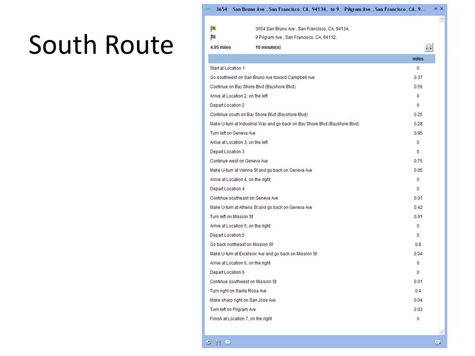
- Closed Highway and rerouted directions
- Any text that public needs to know regarding the incident.
Below you will find links to PDF and Power Point Presentation. You will also have links to ArcGIS Explorer online slides.
ArcGIS Network Analyst slide presentation (ppt)
ArcGIS Network Analyst slide presentation (pdf)


No comments:
Post a Comment